Introduction
The Philippines faces its first potential weather disturbance of the new year. The state weather bureau PAGASA is now monitoring a developing low-pressure area or LPA. This weather system is currently located east of the Philippine landmass. Forecasters have identified this LPA as the possible seed for Tropical Depression ‘Ada’. This marks the first such system to be watched in the year 2026. The movement and development of this LPA are being tracked closely by meteorologists. Its formation signals the ongoing activity of the Pacific weather systems that affect the archipelago. Residents in eastern regions are advised to monitor official updates from PAGASA.
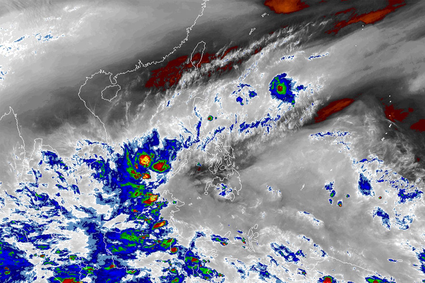
Current Status And Location Of The Low-Pressure Area
As of the latest bulletin, the low-pressure area is situated over the Pacific Ocean. It is positioned east of the Visayas and Mindanao regions of the Philippines. The system is still disorganized but carries the potential for further development. Atmospheric conditions in the area are being analyzed for factors like wind shear and sea surface temperature. These factors will determine whether the LPA gains more strength and structure. Satellite imagery shows a concentrated area of clouds and thunderstorms associated with the disturbance. Its current movement is generally westward, slowly approaching the Philippine Area of Responsibility or PAR.
 Potential Development Into Tropical Depression ‘Ada’
PAGASA forecasts a significant chance for this LPA to develop into a tropical depression. If it organizes and its winds reach a sustained speed, it will be classified as such. The first tropical cyclone for the year will then receive the local name ‘Ada’. This follows the alphabetical naming list prepared by the weather bureau. The process of intensification depends heavily on its environment over the warm ocean waters. Forecast models are being run to project its possible strength and track. The designation of a tropical depression brings with it a different set of public storm warnings. This escalation would prompt more urgent preparations in potentially affected communities.
Projected Track And Areas To Be Affected
Early forecast models suggest a westward to northwestward track for the system. This general path would bring it closer to the eastern coast of the Philippines over the coming days. The regions of Eastern Visayas, Bicol Region, and the eastern parts of Mindanao are initially in the watch zone. These areas are often the first to experience the effects of weather systems coming from the Pacific. The exact track remains uncertain at this early stage of development. The potential for heavy rainfall is the primary concern, even before the system strengthens into a depression. Residents in these areas should prepare for the possibility of rain-induced landslides and floods.
Precautionary Measures Advised By Authorities
PAGASA and the National Disaster Risk Reduction and Management Council or NDRRMC have issued initial advisories. They urge the public, especially those in the eastern seaboards, to stay informed. People should monitor the latest weather bulletins from official sources. Fisherfolk and those with small seacraft are advised not to venture out into the eastern seaboard. Local government units are beginning to check their preparedness resources. The public is reminded to review their family emergency plans and prepare basic emergency kits. These early steps are crucial for ensuring community resilience against the first potential storm of the year.
Understanding The Philippine Storm Naming System
The potential name ‘Ada’ comes from a pre-determined list for 2026. The Philippines uses its own set of names for tropical cyclones that enter its area of responsibility. This list is alphabetical and alternates between male and female names. The first storm of the year gets a name starting with ‘A’. The names are recycled every four years, but destructive names are retired. This system helps the public easily identify and track storms through media and official reports. ‘Ada’ is poised to be the first entry in the 2026 season’s list of weather events remembered by the public.
The Importance Of Early Monitoring And Preparedness
The early identification of this LPA highlights the advances in meteorological technology. It allows for a longer lead time for communities to prepare. The first storm of any year serves as an important reminder for the entire nation. It underscores the constant weather challenges faced by the Philippines. Proactive monitoring and early preparedness can significantly reduce the risks to life and property. As PAGASA continues its 24/7 watch, the public is encouraged to practice vigilance and heed official warnings. The story of ‘Ada’ begins with a cluster of clouds east of the islands, a reminder of nature’s power and the importance of readiness throughout the coming year.